Is Drone Photography Worth It for Your Listing?
- Marcus Fleming
- 2 days ago
- 3 min read
Drone photography has become a standard offering in real estate media packages, but not every listing needs it. Here’s a practical framework for knowing when aerial photography genuinely adds value and when the budget is better spent elsewhere.
What drone photography actually shows buyers
The value of drone photography isn’t just visual variety. It’s information. Aerial shots communicate things that ground-level photography literally cannot.
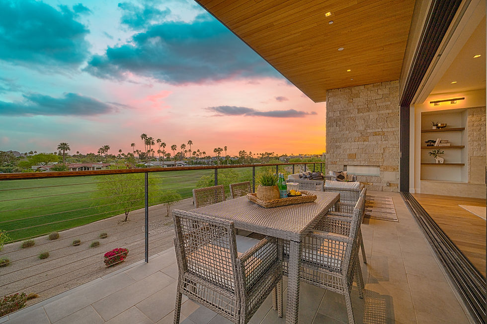
Lot size and layout: A half-acre lot in Queen Creek or a horse property in Scottsdale reads completely differently from 200 feet in the air than from the ground. Buyers who are prioritizing land understand this immediately. Neighborhood context: Proximity to parks, golf courses, lakes, preserves, and community amenities is often a primary driver of value — and it’s invisible at ground level. Drone shots make it visible. Views: Mountain views, city light views, and water views are defining features in Arizona real estate — they exist in the drone shot, or they don’t exist at all in the listing media. Pool and outdoor layout: The aerial perspective shows how the pool relates to the yard, the home, the patio, and any outdoor structures — context that matters to buyers.
Properties where drone photography is table stakes
For certain property types in the Phoenix metro, drone photography isn’t optional — it’s expected: horse properties and large lot homes in Queen Creek, Scottsdale, and Cave Creek; golf course properties in Ocotillo, Gainey Ranch, Troon North, and DC Ranch; lakefront and waterfront homes near Ocotillo, Tempe Town Lake, and Fountain Hills; mountain view properties in Las Sendas, Desert Mountain, Rio Verde, and Gold Canyon; new construction and master-planned community listings where community context matters; and luxury listings over $750K where full media packages are the standard expectation.
For these property types, listing without drone photography leaves money on the table. Buyers searching at these price points expect aerial coverage and will notice its absence.
Properties where you can likely skip it
Standard subdivision homes where the lot is similar to every neighbor and the view is of other houses; condos and attached homes where the lot is minimal and the exterior is shared; tight urban lots in central Tempe or Phoenix where the aerial perspective reveals little; and properties where the primary selling features are entirely interior — finishes, upgrades, layout.
The rule of thumb: if the listing’s value proposition is primarily communicated by what’s visible at ground level, drone photography probably won’t move the needle much.
FAA rules and what they mean for your listing
All commercial drone photography in the US requires an FAA Part 107 certified pilot. This isn’t a technicality — unlicensed drone operators create liability exposure for agents and sellers if anything goes wrong, and the imagery may not be legally usable for commercial purposes.
When hiring a real estate photographer who offers drone services, always confirm they hold a current Part 107 certificate. Every photographer on The Listing Bees team is FAA-certified.
What to expect from a drone shoot
A typical residential drone shoot adds 8–12 aerial photos to a listing package — multiple altitudes, angles, and orientations that show the property and its context from above. Optional aerial video can be combined with ground-level footage for a cinematic listing video.
Most drone shoots are completed during or immediately after the ground-level photography session, with no additional scheduling required. Delivery is included in the standard next-business-day turnaround. At $99, drone photography is one of the most cost-effective additions to a listing package for the properties where it matters most.